
Winter Storm Warning
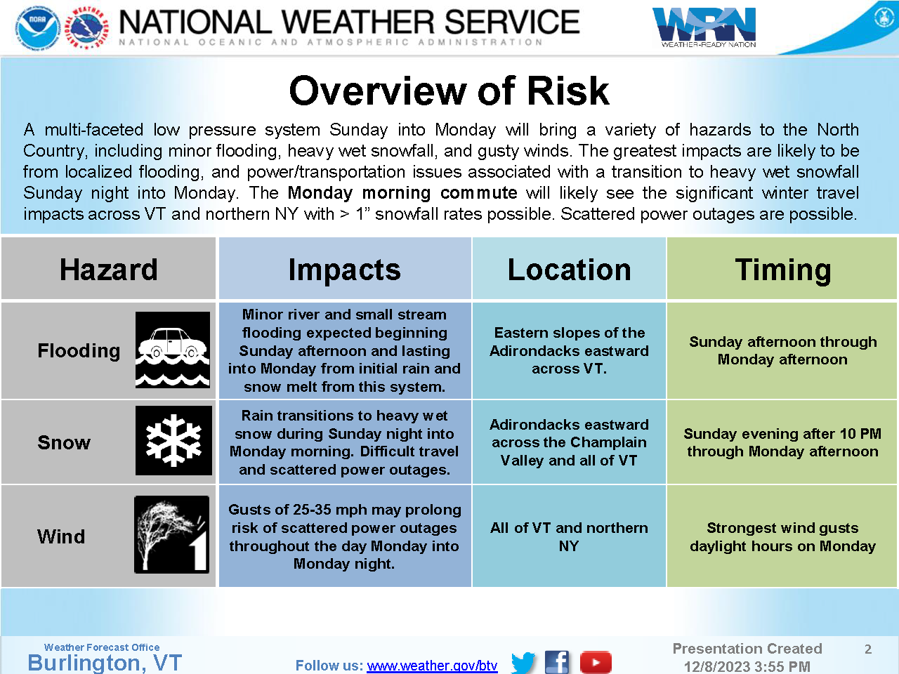
A multi-faceted low pressure system Sunday into Monday will bring a variety of hazards to the North Country, including minor flooding, heavy wet snowfall, and gusty winds.
The greatest impacts are likely to be from localized flooding, and power/transportation issues associated with a transition to heavy wet snowfall Sunday night into Monday. The Monday morning commute will likely see the significant winter travel impacts across VT and northern NY with 1 snowfall rates possible Scattered power outages are possible.
Potential Impacts -
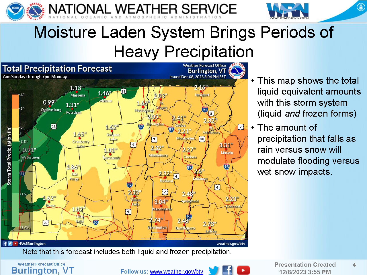
1. Minor river and small stream flooding expected beginning Sunday afternoon and lasting into Monday from initial rain and snow melt from this system.
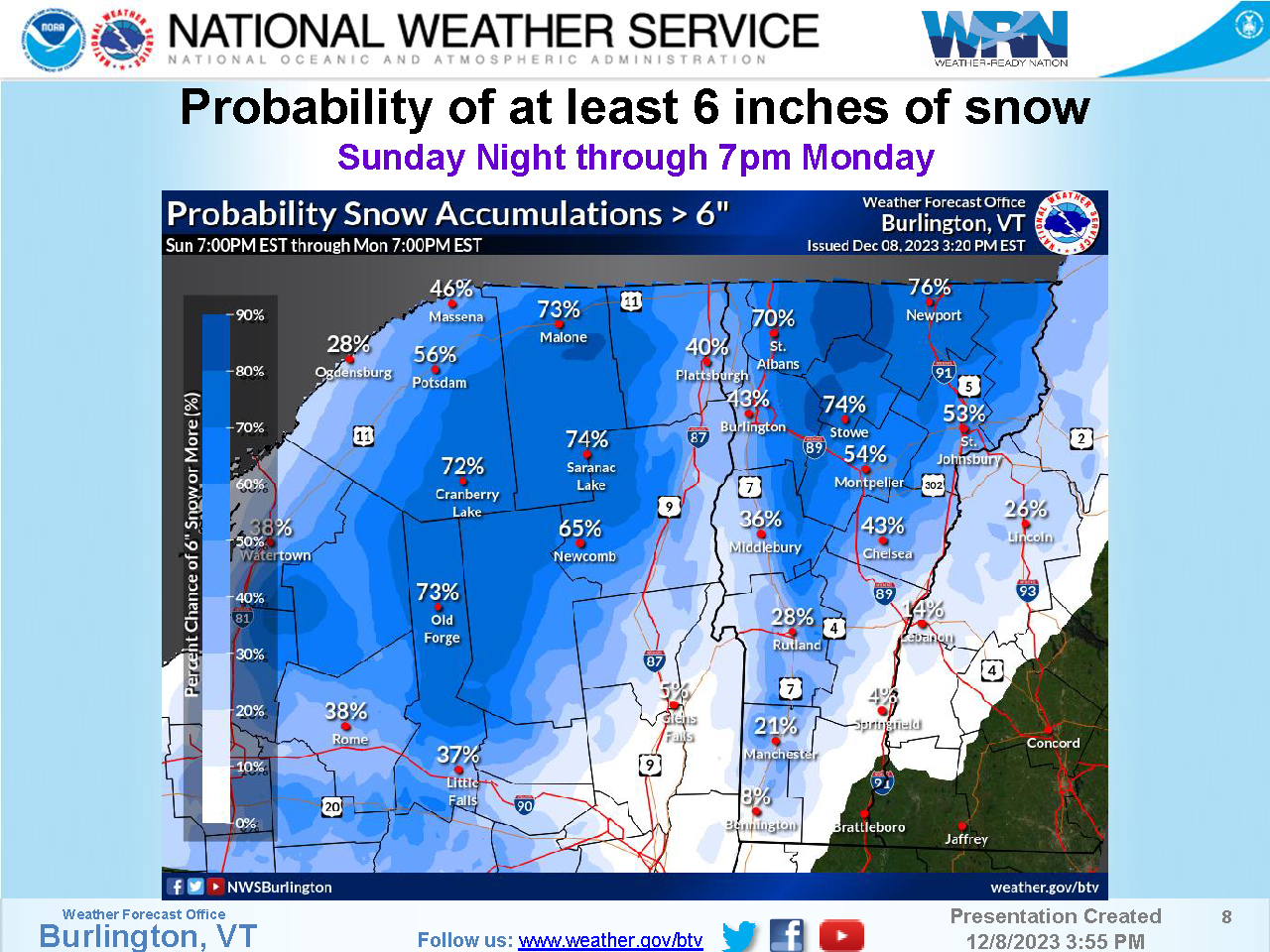
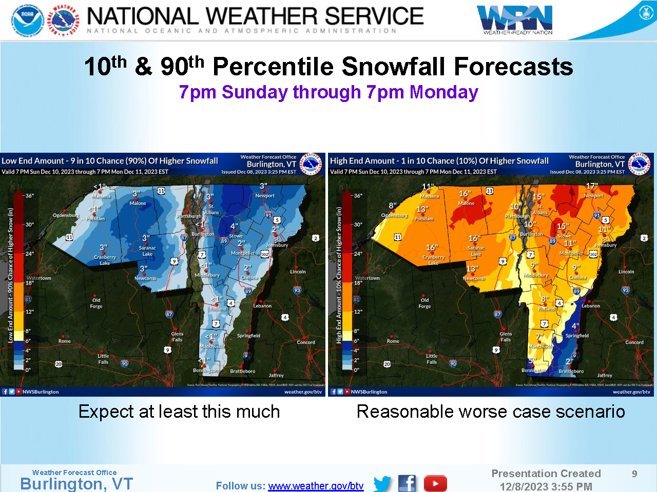
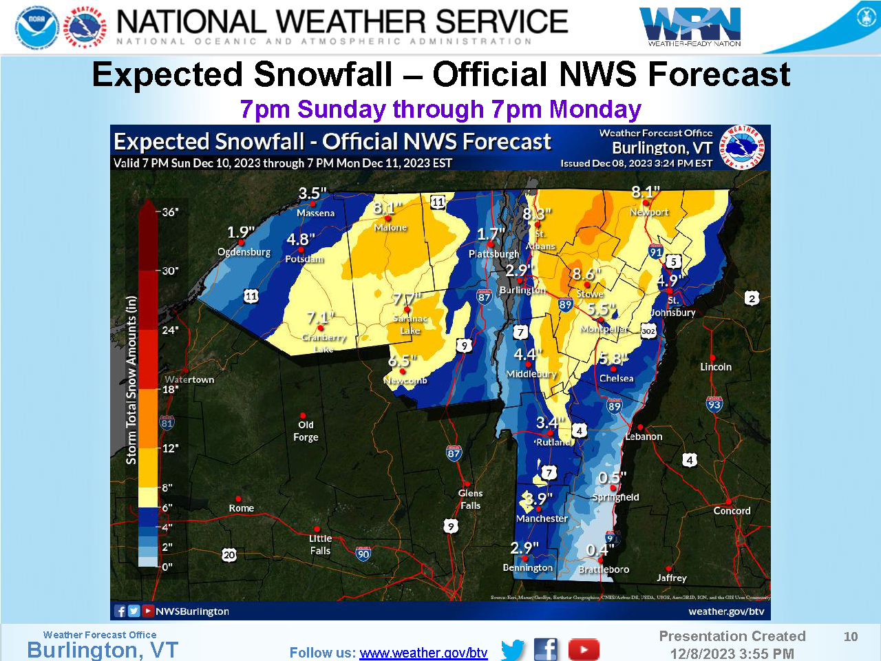
2. Rain transitions to heavy wet snow during Sunday night into Monday morning. Difficult travel and scattered power outages.
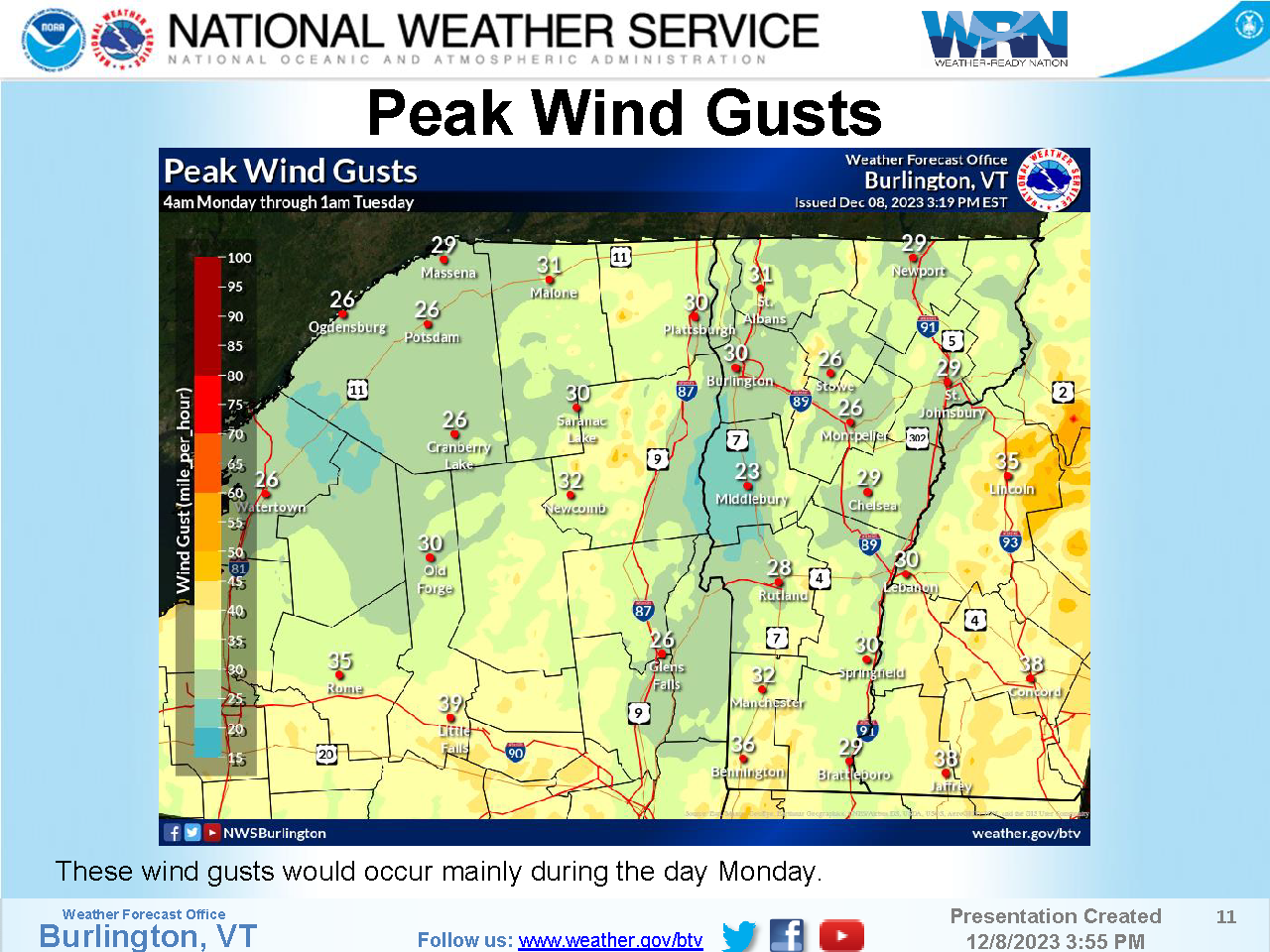
3. Gusts of 25 35 mph may prolong risk of scattered power outages throughout the day Monday into Monday night.
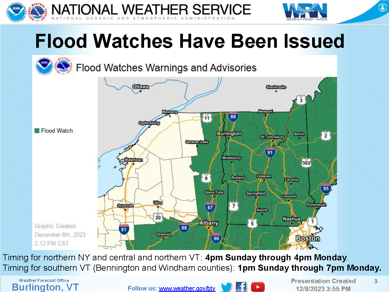
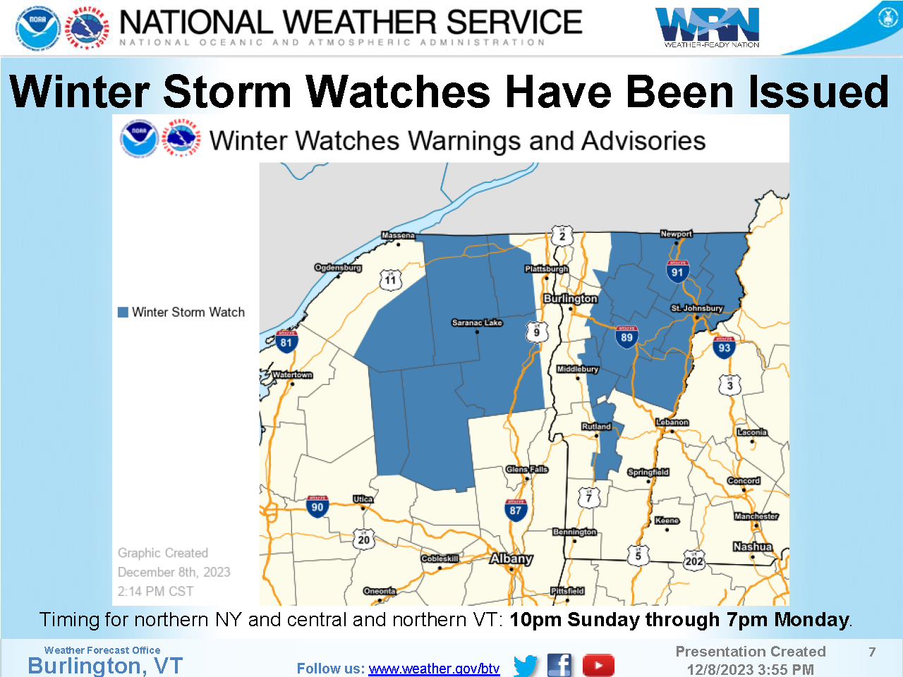
Timing for northern NY and central and northern VT:
4pm Sunday through 4pm Monday
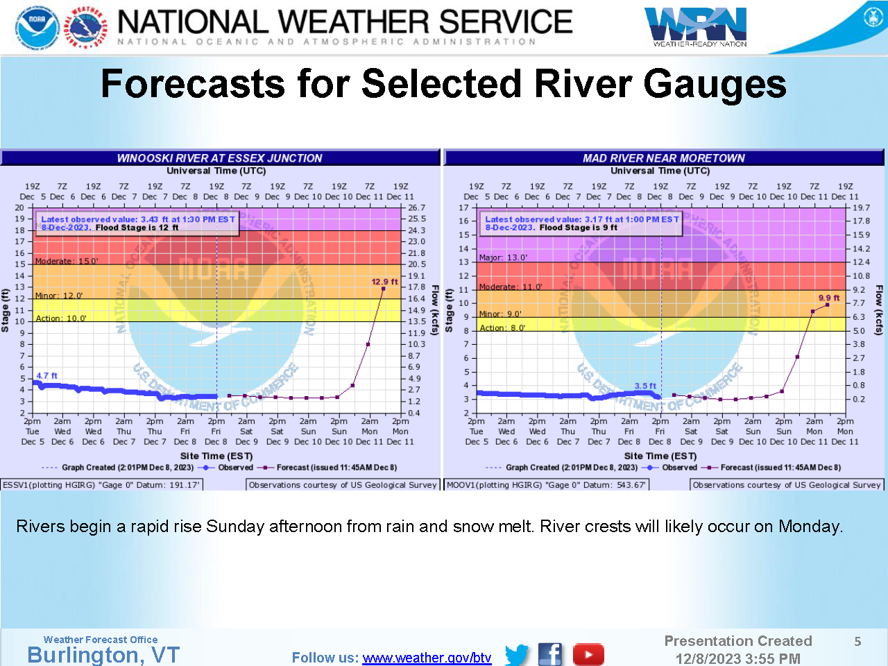
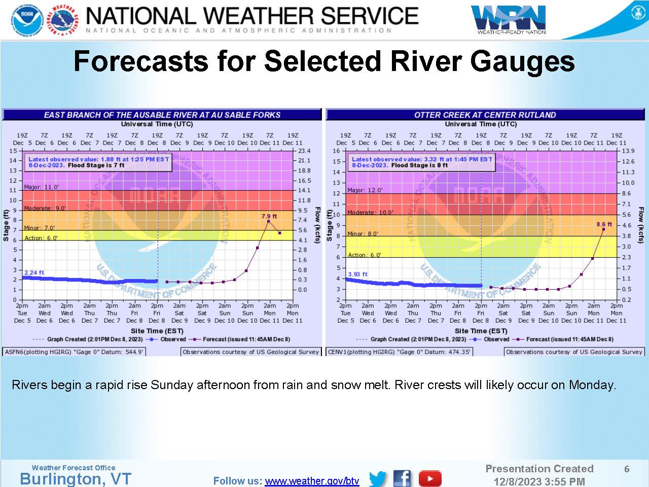
Rivers begin a rapid rise Sunday afternoon from rain and snow melt. River crests will likely occur on Monday.
Web: http://www.weather.gov/btv
| Attachment | Size |
|---|---|
| 161.85 KB | |
| 174.13 KB | |
| 701.62 KB | |
| 864.12 KB | |
| 358.96 KB | |
| 382.65 KB | |
| 436.05 KB | |
| 1 MB | |
| 985.43 KB | |
| 1.24 MB | |
| 1.02 MB | |
| 230.71 KB |